Circumference of Earth: Bridging History to Practical Applications
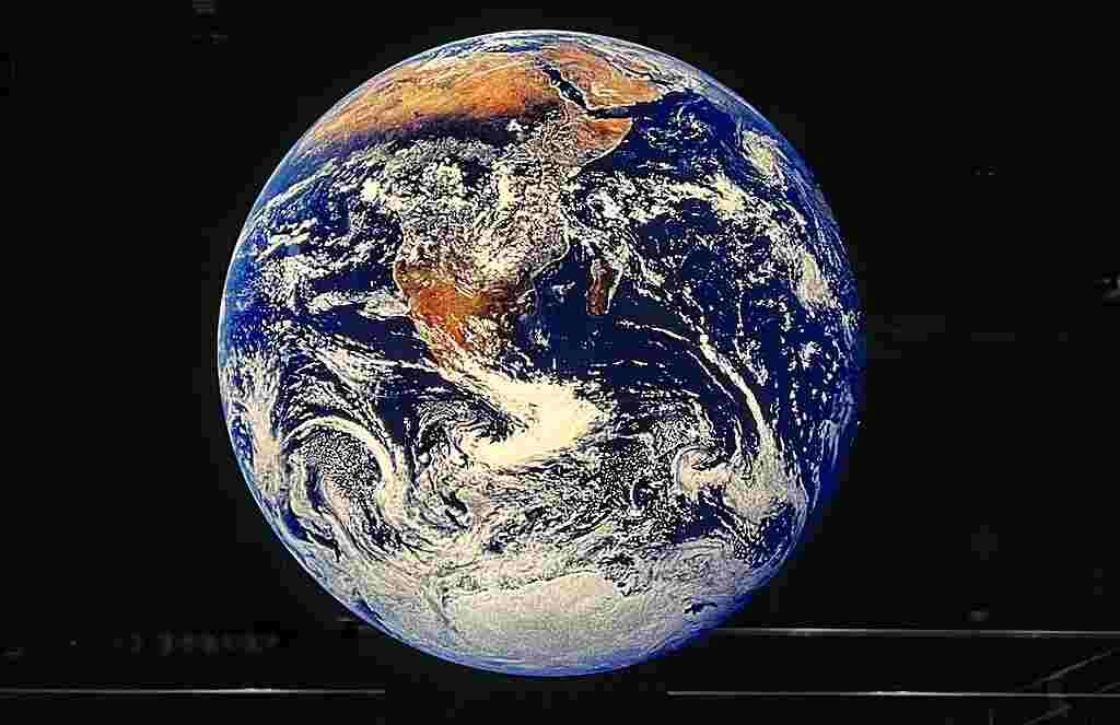
The Earth, our planetary home, is a sphere enveloped in mysteries and wonders. Circumference is a distane around a circle. One of its fundamental attributes is its circumference, a measure that has intrigued scholars and explorers throughout history. The Circumference of Earth, measuring at 24,901 miles or 40,075 kilometers, stands as a fundamental geophysical parameter that has captivated scientists, explorers, and thinkers for generations.
This article delves into the fascinating subject of Earth’s circumference, providing insights in both kilometers and miles.
Understanding Earth’s Circumference
Earth’s circumference is the distance around its equator, forming a complete loop. Circumference of Earth, measuring at 24,901 miles or 40,075 kilometers. This measurement is crucial in fields ranging from geography and navigation to astronomy and geophysics.
Earth’s meridional circumference, measured from pole to pole is different:
Earth’s meridional circumference, measured from pole to pole, is approximately 24,860 miles (40,008 km), slightly shorter than its equatorial circumference. This variation arises due to the planet’s oblate shape, with a slight flattening at the poles and a bulge around the equator. This distinction is important in various fields, including geodesy and satellite-based navigation systems.
Why?
The reason why the circumference of the Earth is different when measured from the poles compared to when measured around the equator has to do with the shape of our planet. Earth is not a perfect sphere; it’s slightly flattened at the poles and slightly bulging at the equator, like a squashed ball.
Imagine if you took a basketball and gently pressed it from the top and bottom. It would become a bit flatter on the top and bottom while getting wider around the middle. That’s similar to the shape of Earth.
Because of this shape, when you measure around the middle (the equator), it’s a bit longer than when you measure from the top to the bottom (the poles). So, even though the Earth is about 24,901 miles (40,075 kilometers) around the equator, it’s a bit shorter, about 24,860 miles (40,008 kilometers), when you go from the North Pole to the South Pole. It’s an interesting quirk of our planet’s shape!
Earth Magnetic Field | Nicknamed “earth shield” by Scientists
Kilometers: The Metric Marvel
The equatorial circumference of Earth, measured in kilometers, is approximately 40,075 kilometers. This figure has been calculated using advanced satellite technology and sophisticated mathematical models.
Miles: The Imperial Insight
For those more familiar with the Imperial system, Earth’s equatorial circumference translates to roughly 24,901 miles. This metric is often used in regions where the Imperial system of measurement prevails.
Historical Endeavors
Throughout history, determining the circumference of Earth has been a monumental task. Ancient civilizations like the Greeks made early attempts using methods such as celestial observations and geometry.
The work of the famed mathematician and astronomer Eratosthenes in the 3rd century BCE provided an early estimate that remarkably aligns with modern measurements.
Eratosthenes’ Ingenious Calculation: In the 3rd century
BCE, the Greek mathematician Eratosthenes made one of the earliest documented attempts to measure Earth’s circumference. By comparing the angles of shadows cast by the sun at two different locations, he estimated the Earth’s circumference with remarkable accuracy.
Eratosthenes’ measures
It was around 250 years before Christ that the first attempts were made to measure the diameter of the Earth. A man named Eratosthenes reasoned like this. Syène was a city whose latitude was located at 23.5 degrees north, that is to say on the Tropic of Cancer. The Ancients knew that on the lines of the tropics the Sun passes the zenith at least once a year.
This date, for the Tropic of Cancer, is June 21 at the summer solstice. In Syène and any place having a northern latitude of 23.5 degrees (Tropic of Cancer), on June 21 at noon, the Sun is at its zenith, its light can be seen at the bottom of a vertically dug well.
But on the same date and at the same time, in the city of Alexandria located further north (31 degrees north latitude), it was noted that the Sun’s rays did not reach the bottom of the wells. The rays were at an angle of 7.5 degrees from the vertical.
Calculating the earth’s circumference
Knowing the distance between the two cities (830 kilometers), we arrived at the following reasoning:
If the Earth were flat, the rays would arrive just as well vertically from Alexandria as vertically from Syene. However, we see a difference of 7.5 degrees and a circumference corresponds to 360 degrees, so it was necessary to cover a distance of 830 kilometers for there to be a difference of 7.5 degrees between the vertical of each location.
So 7.5 degrees = 830 kilometers
360 degrees = X kilometers (X circumference of the Earth)
Let X =(360 / 7.5) * 830
Which gives 39,840 kilometers (circumference calculated by Eratosthenes).
The current accepted value is 40,074 kilometers, so it’s not too bad for the time! The earth’s radius could then be deduced from the circumference.
.png)
Circumference is a distane around a circle. Pearson Scott Foresman, Public domain, via Wikimedia Commons
Modern Measurement Techniques
Today, advanced technologies, including satellites equipped with global positioning systems (GPS), laser ranging systems, and precise geodetic surveys, play pivotal roles in accurately measuring Earth’s circumference. These methods have refined our understanding of our planet’s dimensions.
Modern measurement techniques for determining the circumference of the Earth have evolved significantly from historical methods. Today, advanced technologies and precise scientific instruments are employed to achieve highly accurate measurements. Here are some of the modern techniques used:
- Satellite-Based Methods:
- Global Positioning System (GPS): GPS satellites orbiting Earth transmit signals to ground-based receivers, allowing them to calculate their exact position. By triangulating signals from multiple satellites, precise coordinates and distances can be determined, enabling accurate geodetic measurements.
- Global Navigation Satellite Systems (GNSS): Similar to GPS, GNSS systems like GLONASS (Russia), Galileo (EU), and BeiDou (China) provide additional satellite constellations for improved accuracy in positioning and geodetic applications.
- Satellite Altimetry: Satellites equipped with altimeters measure the height of the sea surface, which is influenced by Earth’s gravitational field. This data, when combined with precise satellite orbits, contributes to the determination of Earth’s shape and dimensions.
- Laser Ranging:
- Ground-based stations use laser beams to track satellites in orbit. By precisely measuring the time it takes for a laser pulse to travel to the satellite and back, scientists can determine the satellite’s exact position. This information is crucial for refining models of Earth’s shape and size.
- Interferometric Synthetic Aperture Radar (InSAR):
- InSAR uses radar waves from satellites to create high-resolution maps of the Earth’s surface. By comparing images taken at different times, scientists can detect minute deformations in the Earth’s crust, aiding in geodetic studies.
- Gravimetry:
- Gravimetric surveys involve measuring variations in Earth’s gravitational field. Sophisticated instruments, such as gravimeters, are used to detect minute changes in gravitational acceleration, which can provide information about the density distribution within Earth’s interior.
- Geodetic Surveys:
- Ground-based surveys involve precise measurements of distances and angles between points on the Earth’s surface. Advanced instruments, like Total Stations and Differential GPS, ensure high levels of accuracy.
- Satellite Geodesy:
- Earth observation satellites equipped with instruments like radar altimeters and Synthetic Aperture Radar (SAR) play a crucial role in geodetic studies. They provide data on surface elevation, topography, and land deformation.
These modern techniques, often used in combination, contribute to an ever-refining understanding of Earth’s shape and size. They are instrumental in various scientific disciplines, including geodesy, geophysics, oceanography, and space science. Additionally, these measurements have practical applications in navigation, engineering, environmental monitoring, and more.
Practical Significance
The knowledge of Earth’s circumference is not merely an intellectual pursuit. It has direct practical applications in fields like cartography, aviation, and space exploration. Accurate circumferential data is indispensable for creating precise maps, calculating flight routes, and executing interplanetary missions.
Why do we need to know Circumference of earth? what for?
Understanding the circumference of the Earth serves several important purposes across various fields of study and practical applications:
- Navigation and Cartography: The knowledge of Earth’s circumference is fundamental for creating accurate maps and navigation systems. It helps in determining distances, routes, and positions on the globe.
- Aviation and Space Exploration: Pilots, astronauts, and space agencies use Earth’s circumference to calculate flight paths, trajectories, and orbits. It ensures precise navigation and safe travel.
- Satellite Communication and Positioning: Systems like GPS (Global Positioning System) rely on precise measurements of Earth’s circumference. It enables accurate location-based services, such as navigation, tracking, and mapping.
- Surveying and Geodesy: Land surveyors and geodesists use Earth’s circumference in the calculation of distances and the establishment of accurate boundaries for construction, infrastructure, and land development.
- Oceanography and Marine Navigation: Ship captains and marine scientists use the Earth’s circumference to plan sea routes, estimate travel times, and calculate distances for maritime travel.
- Astronomy and Astrophysics: Earth’s circumference is a fundamental parameter for astronomers studying celestial objects, tracking satellites, and planning space missions.
- Timekeeping and Calendar Systems: Earth’s rotation period (day) is directly related to its circumference. This knowledge is essential for calibrating time standards and designing calendar systems.
- Education and Scientific Research: Understanding the dimensions of our planet is a fundamental concept in earth sciences and geography. It forms the basis for many academic studies and research endeavors.
- Historical and Cultural Significance: Throughout history, determining Earth’s circumference has been a significant intellectual pursuit. It was a milestone achievement in human understanding.
- Engineering and Infrastructure: Engineers and urban planners use Earth’s circumference for large-scale projects like bridges, tunnels, and highways, ensuring accurate measurements for construction.
In summary, the knowledge of Earth’s circumference is not only a fundamental aspect of our understanding of the planet, but it also has practical implications across a wide range of disciplines, from navigation and space exploration to engineering and education. It underpins our ability to navigate, explore, and make informed decisions about our world and beyond.
Conclusion: A Global Grasp
Understanding Earth’s circumference in both kilometers and miles offers a deeper appreciation for the dimensions of our planet. From ancient philosophers to modern scientists, this fundamental measurement continues to inspire awe and ignite exploration. As we gaze at maps and globes, let us remember the remarkable journey of discovery that has brought us this knowledge.
In essence, Earth’s circumference serves as a global girdle, encircling our world and connecting us all.
Sources: Union University, Space, PinterPandai
Photo credit (main page): Burkhard Mücke, CC BY-SA 4.0, via Wikimedia Commons